
As a provider of an interactive map and virtual tour platform for higher education, this is question we hear on a somewhat regular basis: “do people really use interactive campus maps?” Fortunately, our team at CampusBird can confidently answer: “absolutely!” Campus maps are used by roughly 65 percent of prospective students when selecting a school but when campus maps really do shine is when we dig into how people are using interactive campus maps.
We have access to some fun data that gives us a powerful snapshot about how people are using interactive maps and the virtual tour systems within the CampusBird platform.
Here’s What We Know
For a typical campus map at a mid-sized school, we see steady daily traffic, particularly for schools who use interactive maps as wayfinding tools, to highlight a specific area of the map for events, etc., as well as a tool to highlight ADA accessible routes and entrances. We see hundreds of virtual tour “plays” every month–twice that for bigger schools. General campus tours, dorm tours and specific athletic tours tend to be top performers.
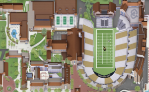
We see mobile and desktop traffic shift back and forth: on regular weekdays, it’s about 60 percent desktop, 40 percent mobile. That flips almost exactly if there’s a big event, such as a football game, when people are in the passenger seat helping the driver get to campus, find parking and the tailgating area, or are already on campus looking for the fastest walkway from points A to B. Arizona State University, Colorado State University and Texas A&M have incredible game-day map “layers” set up that help guide people to and fro, highlight traffic diversions, parking and other game-day needs.
But when it really gets exciting is on move-in day and the first day of school. During the move-in day through the first day of school interactive map traffic goes up more than 200 percent. Colleges and universities are getting really savvy using campus maps as a move-in day tool because it’s a one-stop shop for students, parents and staff alike. From dorms to information stations to dining, highlighting long-term and short-term drop off parking locations, even nearby locations to recycle cardboard boxes, anything to make move-in day easier is welcomed.
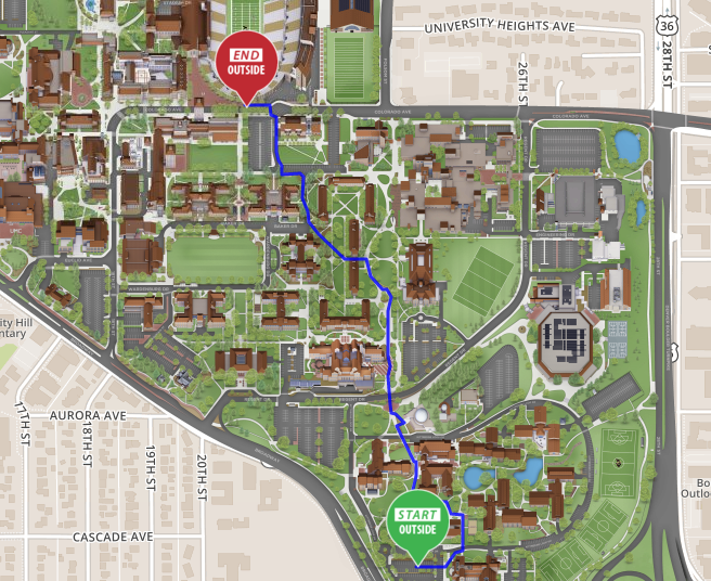
The University of Colorado Boulder launched their new CampusBird interactive map right before the 2017/2018 academic year, and used it for move-in day. Like many colleges and universities, CU Boulder has a beautiful campus and they wanted to bring that experience online. But they also want to show what’s off-campus, and used their new interactive map to highlight regional hiking trails, ski resorts and national parks, as well as a Boulder Bucket List virtual tour. All of this gives online visitors a powerful navigational tool and also gives prospective students a fun experience that can help steer them toward scheduling an in-person college tour.
Use Outside of Students
But aside from students and upticks around special events, who else uses interactive maps?
Alumni appreciate the chance to easily revisit old stomps and see what’s changed on campus, and it can help them get excited for an alumni weekend (and even find a nearby hotel).
As the users of the backend software, staff are able to pull facilities data with housing and dining information and all other campus data into one place for easy access for students and visitors. Faculty are able to help people easily find locations through the map, and CampusBird gives faculty and staff a place to collect all that content into our CMS and display it for students as well as other faculty and staff.
From marketing to athletics, alumni relations to communications, new student orientation and more, there are thousands of uses for an interactive map in the higher education setting. People are visiting your website, looking for a continuation of the on-campus experience and maps can uniquely provide that experience.

Samantha Slater is marketing manager for concept3D, developer of the CampusBird Interactive Map and Virtual Tour platform. Learn more at www.concept3d.com
- Using real-world tools to prepare students for the workforce - April 18, 2024
- 8 top trends in higher education to watch in 2024 - April 16, 2024
- Defining a path to equitable AI in higher education - April 12, 2024